On July 11, 2025, I started the Silverheels 100-mile trail run under a full moon at 4am in the morning. My journey to that moment in time included over a decade of searching for limits and working towards a future of unknown possibilities (a.k.a. trail and ultra running). Before I get into the details of race day, I want to take a moment to reflect on why I chose to show up for this daunting adventure.
I ran my first 100-mile race in 2024, the Antelope Canyon 100-miler in Page, AZ. It felt like a safe choice to see if I could accomplish the distance. It was a desert race at a lower elevation than where I live, and it only had 8,000 feet of climbing. Anyone who knows me knows that climbing is my nemesis. Having finished that race in a bit under 29 hours, I knew I was capable of the distance. But now, it was time to level up. For my next goal, I wanted to choose a 100-mile race in the mountains. This was something I truly did not know if I was capable of accomplishing. Although I have lived in Colorado for over four years now, I grew up in flatland Minnesota, and these mountains have never stopped feeling hard. I had a difficult time deciding which race to choose. This endeavor was monumental, so the race had to carry deep meaning to me.
I don't want to name other races here and explain why I didn't choose them. I will just say that Silverheels 100, created by race director John Lacroix at the Human Potential Running Series (HPRS), had some appealing qualities that resonated with me. HPRS values community over competition, belongingness, and caring about each individual runner out on the course. Each race brings old-school vibes without podiums, public live-tracking, or live streams. It was a place where I felt like I could show up to try something hard and be truly supported and cared for all the way through.
The 100-mile and 100K races started together at the Burning Bear Trailhead off Geneva Road in Grant, CO. This was the first year the race started in this location as the course was recently revamped and redesigned. This trail consisted of lovely, runnable single track through pine forest. There was a long climb, then descent that dropped you onto a gravel road and into Handcart Aid Station (mile 7.7). This year, the first aid station included a mandatory gear check as the forecast called for classic mountain monsoon weather: cold rain, possible hail, and thunderstorms. I passed the gear check and got to hug my husband, Ryan, and son, Alex, who were volunteering there before heading out for the most difficult and magical part of the course.
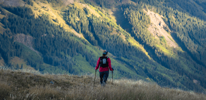
I started a long, steep climb that ascended well over 12,000 feet in elevation up to Red Cone Peak and Webster Pass. I had been dreaming of this moment for months. Expectations were already high, but reality exceeded all of them. This part of the course was truly epic, and I didn't want to rush it. I met a few different runners on the ascent, and we smiled and basked in the beauty surrounding us. We saw mountain goats and mountain peaks and felt like we were on top of the world! After Webster Pass, the route hopped on to the Continental Divide Trail and eventually descended down a technical jeep road into Swandyke Aid Station (mile 20.2).

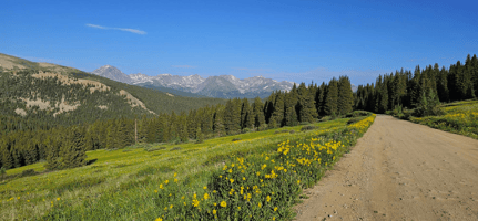
The next part of the course consisted of some non-technical gravel roads and fantastic single track. I made up some time here and passed multiple runners using a consistent run/walk strategy on the flats and downs and a strong power hike on the ups. There was a long section of mostly flat single track here through a dense pine forest. The final climb up to Georgia Pass Aid Station got steep and difficult. Another runner and I were cursing Mother Nature because despite the sky being mostly dark with stormy-looking clouds, the scorching sun somehow remained focused on us the entire climb. Until it didn't.
The moment I reached Geogia Pass Aid Station (mile 29.7), the sky went completely dark. Thunder rumbled nearby. I wanted to take some time here, but I also didn't want to risk being told I couldn't continue on due to the storm. I knew the next part of the course was a long descent and safer than being on the pass, so I rushed out of the aid station almost as soon as I arrived. I ran down a short stretch of non-technical gravel road and onto a runnable trail that kept descending for miles. When it started raining, I stopped to put on my rain jacket. When it started hailing, I put on my rain pants too. Luckily, the rain and hail remained mild and short-lived, and I arrived at Michigan Creek Aid Station (mile 35) feeling great!
I was greeted here by my crew, Ryan, Alex, and Amy! I think they were surprised to see me feeling so happy. I was told there had been some carnage on the course so far, but I was on cloud nine and just getting started! I took some time to eat and grab more gear. I wouldn't see them again until night, so I needed to be prepared with lights and layers to stay warm. I kept my rain pants on for lack of space in my pack, threw my rain coat around my waist, and headed out for the next section!
After a short stretch of gravel road, I hopped onto French Gulch Trail. The trail was lovely and opened up into fields of wildflowers surrounded by mountain peaks. The rain was holding off but there was a low and constant rumble of thunder as I made my way up towards French Pass. I was questioning whether it was safe to go over the pass, but I hadn't seen any lightning yet, and there was another runner just ahead of me making the ascent. I caught up to him on the snowfield just below the pass. Suddenly, it started raining and hailing, with lightning finally making its way out of the clouds nearby! At this point, the safest option was to get down low to tree line, but since we were basically on the pass already, we decided to push on over to the other side and descend as quickly as possible. I didn't feel safe stopping to put on my rain jacket, so I endured the cold rain until we finally made it to safer ground. I put on everything I had, grateful for the gear I was required to carry. The trail ended on a nice, non-technical gravel road, and I enjoyed an easy descent into French Gulch Aid Station.

I was so glad I planned ahead for this stop! I had a drop bag at French Gulch Aid Station (mile 44.1) that included fresh socks, shoes, and warm, dry layers (I packed everything in plastic bags in case of rain). I took some time here to change and eat. The sun was out again, and I was still feeling great!
The next section was a long, gradual climb. Terrain consisted of non-technical gravel roads and some really nice single track. If I was running a shorter race, I might've tried to run more of the lower-graded uphill, but I was only around halfway and wanted to make sure to manage my effort. Night fell over the course on this stretch, and I got to Boreas Pass Aid Station (mile 53.4) in the dark. I didn't take much time at this aid station. The next section was only 4.6 miles downhill where I would meet my crew and pick up my pacer, Amy!
I thought it was going to be a quick and happy descent, but this is the section where everything started to change. Some pain was setting in, and I decided to try and take some Tylenol. Unfortunately, trying to take the pills using a straw triggered my gag reflex, and I ended up puking up everything in my stomach. After that, heavy nausea set in, and I didn't know what to do! I was trying to make my way down what I thought would be a quick, easy descent, but the trail down to Tarryall Aid Station was extremely rocky and technical. A fall on that trail would've been hugely consequential, so I took it easy and mostly hiked it in.
I made it to Tarryall Aid Station (mile 58) later than I expected. I told my crew what had happened. I tried to eat some different foods, but everything was making me gag. Despite this, we switched out my flasks with the same Gu Rocktane I had been drinking all day, and I set off with my pacer. We decided to just take it easy and hope that the nausea would subside on the way to the next aid station. I realized that every time I took a sip of Rocktane, the nausea got worse. I needed to start troubleshooting other options.

It took us about three hours to get to Crooked Creek Aid Station (mile 65.7), and I was still feeling nauseous. I was able to eat a pickle and some Nerd Clusters. Instead of Rocktane, we filled my flasks with Coke and a mixture of ginger ale and water. It was getting colder, and I decided to put on a second pair of pants, layer a puffy winter jacket over my Patagonia Nano Air Hoody, and use the serious winter mittens I brought that would also be appropriate for snowboarding in the dead of winter. It may sound like overkill, but I did not regret these decisions! The low was in the 30s, it was pitch dark, and there was a consistent cold breeze.
Before we left Crooked Creek Aid Station, I tried hinting to Ryan that I would like him to be at the next aid station as well. The plan now was for him to get some sleep, but I was secretly starting to doubt my ability to overcome the nausea and finish this race. Ryan told me that as long as I'm not bonking, I can keep going. And even if I do bonk, I just need to slow down. I could tell I wasn't off the hook yet (and I wasn't bonking), so Amy and I headed to the next aid station knowing there wouldn't be a safety net there to drive me home.
Upon arrival to Poor Man's Aid Station (mile 70), I declared out loud that I wasn't doing well. I was received by some very friendly and supportive aid station volunteers who helped me continue to troubleshoot, even giving me their own personal gels and a banana to try. The gel was a bust, but I got the banana down. We decided to keep the Coke and ginger ale going for lack of a better idea. Amy gently reminded me that Ryan told me not to spend too much time in aid stations, so I reluctantly joined her for the next section of the race.
Despite the sky starting to turn lighter, my thoughts were getting darker. I was annoyed that I had to complete a 15.5-mile section of the course before I would see Ryan again and could finally drop. This next section was a long ascent up a gravel road that got steeper and more technical every mile. As we were approaching what looked like the final ascent, the visual steepness of it broke me. Amy was well ahead of me when I exclaimed out of nowhere, "I DON'T THINK I CAN DO THIS!!!"
I collapsed on the side of the road and sobbed. It's too hard. I can't do it. I wanted to skip the torture of finishing this section and just turn around, head back to Poor Man's, and officially drop. Amy came down and sat beside me. She said some words that I can't remember, because they didn't enter into my ears - they went through me, into the core of my being which then decided that I could, in fact, keep going.
We made that final ascent and landed at High Park Aid Station (mile 75.4). I immediately took off my pack and laid on the ground sobbing in the fetal position with my jacket over my face. Yes, this was peak vulnerability and something I absolutely could not avoid. A volunteer offered me a bed in the back of his truck, and I accepted. I sobbed into the pillow he gave me and tried to grab a few minutes of sleep, but my body would not allow it. I got out of the truck bed, laid on the ground and took my shoes off (my feet were severely painful). The same volunteer brought over a small cooler for me to elevate my feet, and he offered to massage my feet. MASSAGE MY FEET! AT MILE 75! Hero.

I managed to eat a tortilla with Nutella and drink a few cups of water. My nausea was slowly subsiding, and I decided to try Skratch so I could at least get a small number of liquid calories and some electrolytes. The next part of the course took us out to the Silverheels Mine, which is the turn-around point for the second half of the course. When we arrived, I was still skeptical about finishing, but Amy had a text from Ryan saying that I was still ahead of my "C" pace on my pacing chart. The "C" pace meant that I was ahead of cutoffs and only had to maintain consistent forward progress in order to finish the race. Amy asked me if I thought I could do it. I said I wasn't sure, and we left the mine to head back to High Park Aid Station. But after a few minutes of mulling it over, I made the decision that I COULD DO IT. I told Amy, and we made a plan to just move as quickly and efficiently as we possibly could (which basically meant power hiking our butts off).
When we got back to High Park Aid Station (mile 80), I was a changed woman. I told them we were going for it! I filled my flasks with more Skratch that was sitting well in my stomach and we charged out of there! We booked it down that long, unforgiving road back to Poor Man's Aid Station (mile 85.5) where Ryan and Alex were waiting for us. Luckily for them, Amy and I were on a mission and had a plan that didn't include giving up! We switched out our winter gear for summer gear, refilled flasks again, and took off.
When we got to Crooked Creek Aid Station (mile 93.3) by way of an unnecessarily long and hilly route, we decided that Ryan would take over pacing duties for the remainder of the race. It was not the original plan for me to have a pacer all the way to the end, but I will be eternally grateful for the way Amy stuck with me for over fourteen and a half hours and for Ryan stepping in and accompanying me to the end which would still take an additional five hours. Alex helped Amy navigate our SUV to the next aid station and on to the finish. Ultra running is a team sport, and I had the best one possible.
There was still one aid station to go before we could make our way to the finish. If you're doing the math in your head, then yes, the course long! The trail back to Tarryall Aid Station (mile 101) included a lot of climbing, including one last, steep, relentless climb that we broke into sections to complete. We would hike up a number a steps, and then Ryan would allow a 10-second break. We did this multiple times, and I only sat down in exhaustion once! Somehow, some way, we did finally make it up that final climb and into the final aid station a half hour ahead of cutoff!

We met up with Amy and Alex at this final aid station and only took a short time to grab some more layers (it was cooling down) and got out of there. We now had over two and a half hours to go 5.5 miles. We kept making our relentless forward progress and made it to the finish line with around an hour to spare! I FREAKING DID IT!!!!!
Race stats according to my Coros watch: 109.62 miles, 18,192 feet of climbing, average elevation around 10,800 feet, 39 hours, 1 minute.
Race stats according to my heart: Never have I willingly chosen an experience that would build me up to euphoric heights before dropping me down and breaking me completely open. I did not know I could rise from that kind of low point. I did not know how my family, friend, and perfect strangers would support me on every level. The highs, the lows, and everything in between. Everyone there wanted me to succeed. And I freaking did.

Jen and Ryan Wold are UESCA certified ultrarunning coaches. Click here to learn more!